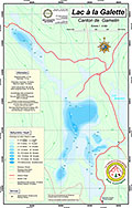
| 33 | À la Galette Lake | Individual Chart | Lanaudière | $15.99 |
| 33 | À la Galette Lake | Stretched Canvas | Individual Chart | Lanaudière | $79.99 |
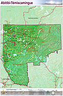
| 522 | Abitibi-Témiscamingue Region | Individual Map | Abitibi-Témiscamingue | $34.99 |
| 522 | Abitibi-Témiscamingue Region | Stretched Canvas | Individual Map | Abitibi-Témiscamingue | $124.99 |
| 39 | Achigan Lake | Individual Chart | Laurentians | $15.99 |
| 39 | Achigan Lake | Stretched Canvas | Individual Chart | Laurentians | $79.99 |
| 183 | Adirondack Park | Individual Map | New York | $29.99 |
| 183 | Adirondack Park | Stretched Canvas | Individual Map | New York | $119.99 |
| 243 | American Indian Nations: Large | Individual Chart | Côte-Nord | $24.99 |
| 243 | American Indian Nations: Large | Stretched Canvas | Individual Chart | Côte-Nord | $119.99 |
| 242 | American Indian Nations: Small | Individual Chart | Côte-Nord | $24.99 |
| 10 | Aylmer Lake | Individual Chart | Chaudière-Appalache | $15.99 |
| 10 | Aylmer Lake | Stretched Canvas | Individual Chart | Chaudière-Appalache | $79.99 |
| 274 | Balsam and Cameron Lakes | Individual Chart | Kawartha Lakes | $24.99 |
| 274 | Balsam and Cameron Lakes | Stretched Canvas | Individual Chart | Kawartha Lakes | $124.99 |
| 148 | Bancroft District | Individual Map | Bancroft | $29.99 |
| 148 | Bancroft District | Stretched Canvas | Individual Map | Bancroft | $124.99 |
| 519 | Baptiste and Elephant Lakes | Individual Chart | Bancroft | $24.99 |
| 174 | Baptiste and Elephant Lakes | Individual Chart | Bancroft | $15.99 |
| 174 | Baptiste and Elephant Lakes | Stretched Canvas | Individual Chart | Bancroft | $79.99 |
| 519 | Baptiste and Elephant Lakes | Stretched Canvas | Individual Chart | Bancroft | $124.99 |
| 40 | Baskatong Reservoir including Lake Piscatosine (Folded) | Individual Chart | Outaouais | $22.99 |
| 278 | Bay of Quinte: Trenton - Kingston | Nautical Chartbook | Bay of Quinte | $49.99 |
| 880 | BC Coast: Broughton Islands | Nautical Chartbook | British Columbia | $149.99 |
| 667 | BC Coast: Desolation Sound | Nautical Chartbook | British Columbia | $54.99 |
| 879 | BC Coast: Desolation Sound to Sonora Island | Nautical Chartbook | British Columbia | $52.99 |
| 665 | BC Coast: Horseshoe Bay - Jervis Inlet | Nautical Chartbook | British Columbia | $59.99 |
| 892 | BC Coast: Ladysmith - Saturna | Nautical Chartbook | British Columbia | $57.99 |
| 666 | BC Coast: Parksville - Campbell River | Nautical Chartbook | British Columbia | $54.99 |
| 891 | BC Coast: Parksville - Ladysmith | Nautical Chartbook | British Columbia | $54.99 |
| 893 | BC Coast: Sansum Narrows - Esquimalt Harbour | Nautical Chartbook | British Columbia | $57.99 |
| 890 | BC Coast: Squamish (Horse Shoe Bay) - Tsawwassen | Nautical Chartbook | British Columbia | $57.99 |
| 889 | BC Coast: Vancouver Harbour - Indian Arm | Nautical Chartbook | British Columbia | $64.99 |
| 894 | BC Coast: Victoria and Esquimalt Harbours | Nautical Chartbook | British Columbia | $57.99 |
| 159 | Beauchamp Lake | Individual Chart | Lanaudière | $15.99 |
| 159 | Beauchamp Lake | Stretched Canvas | Individual Chart | Lanaudière | $79.99 |
| 95 | Beauport Lake | Individual Chart | Quebec (Capital) | $15.99 |
| 95 | Beauport Lake | Stretched Canvas | Individual Chart | Quebec (Capital) | $79.99 |
| 134 | Big Gull lake | Individual Chart | Land O'Lakes | $15.99 |
| 134 | Big Gull lake | Stretched Canvas | Individual Chart | Land O'Lakes | $79.99 |
| 238 | Black and Pike Lakes | Individual Chart | Frontenac | $24.99 |
| 238 | Black and Pike Lakes | Stretched Canvas | Individual Chart | Frontenac | $124.99 |
| 155 | Black Lake | Individual Chart | Frontenac | $15.99 |
| 155 | Black Lake | Stretched Canvas | Individual Chart | Frontenac | $79.99 |
| 76 | Blue Sea Lake | Individual Chart | Outaouais | $15.99 |
| 76 | Blue Sea Lake | Stretched Canvas | Individual Chart | Outaouais | $79.99 |
| 169 | Bobs Lake and Crow Lake | Individual Chart | Frontenac | $29.99 |
| 169 | Bobs Lake and Crow Lake | Stretched Canvas | Individual Chart | Frontenac | $124.99 |
| 222 | Boshkung and Twelve Mile Lakes | Individual Chart | Haliburton | $24.99 |
| 222 | Boshkung and Twelve Mile Lakes | Stretched Canvas | Individual Chart | Haliburton | $124.99 |
| 195 | Bras d'Or Lake: Île Madame to Baddeck | Nautical Chartbook | Nova Scotia | $52.99 |
| 11 | Brome Lake | Individual Chart | Estrie | $15.99 |
| 11 | Brome Lake | Stretched Canvas | Individual Chart | Estrie | $79.99 |
| 12 | Brompton Lake | Individual Chart | Estrie | $15.99 |
| 12 | Brompton Lake | Stretched Canvas | Individual Chart | Estrie | $79.99 |
| 450 | Buck Lake | Individual Chart | Frontenac | $15.99 |
| 450 | Buck Lake | Stretched Canvas | Individual Chart | Frontenac | $79.99 |
| 190 | Buckhorn and Chemong Lakes | Nautical Chartbook | Trent-Severn | $29.99 |
| 191 | Buckhorn, Chemong and Pigeon Lakes | Individual Chart | Kawartha Lakes | $29.99 |
| 191 | Buckhorn, Chemong and Pigeon Lakes | Stretched Canvas | Individual Chart | Kawartha Lakes | $124.99 |
| 510 | Cabonga Reservoir (Folded) | Individual Chart | Outaouais | $22.99 |
| 128 | Calabogie Lake | Individual Chart | Ottawa Valley | $15.99 |
| 128 | Calabogie Lake | Stretched Canvas | Individual Chart | Ottawa Valley | $79.99 |
| 449 | Canoe Lake | Individual Chart | Frontenac | $15.99 |
| 449 | Canoe Lake | Stretched Canvas | Individual Chart | Frontenac | $79.99 |
| 34 | Cartier (Provost) Lake | Individual Chart | Lanaudière | $15.99 |
| 34 | Cartier (Provost) Lake | Stretched Canvas | Individual Chart | Lanaudière | $79.99 |
| 79 | Cayamant Lake | Individual Chart | Outaouais | $15.99 |
| 79 | Cayamant Lake | Stretched Canvas | Individual Chart | Outaouais | $79.99 |
| 251 | Chandos Lake | Individual Chart | Haliburton | $24.99 |
| 251 | Chandos Lake | Stretched Canvas | Individual Chart | Haliburton | $124.99 |
| 150 | Chapleau Lake | Individual Chart | Laurentians | $15.99 |
| 150 | Chapleau Lake | Stretched Canvas | Individual Chart | Laurentians | $79.99 |
| 214 | Charleston Lake | Individual Chart | Frontenac | $24.99 |
| 214 | Charleston Lake | Stretched Canvas | Individual Chart | Frontenac | $124.99 |
| 42 | Chaud Lake | Individual Chart | Laurentians | $15.99 |
| 42 | Chaud Lake | Stretched Canvas | Individual Chart | Laurentians | $79.99 |
| 72 | Chibougamau Lake (Folded) | Individual Chart | Northern Quebec | $22.99 |
| 225 | Christie Lake | Individual Chart | Frontenac | $24.99 |
| 225 | Christie Lake | Stretched Canvas | Individual Chart | Frontenac | $124.99 |
| 43 | Connelly Lake | Individual Chart | Laurentians | $15.99 |
| 43 | Connelly Lake | Stretched Canvas | Individual Chart | Laurentians | $79.99 |
| 215 | Cranberry and Dog Lakes | Individual Chart | Frontenac | $22.99 |
| 23 | Croche Lake | Individual Chart | Lanaudière | $15.99 |
| 23 | Croche Lake | Stretched Canvas | Individual Chart | Lanaudière | $79.99 |
| 557 | Dasserat Lake | Individual Chart | Abitibi-Témiscamingue | $29.99 |
| 543 | Dasserat Lake | Individual Chart | Abitibi-Témiscamingue | $15.99 |
| 543 | Dasserat Lake | Stretched Canvas | Individual Chart | Abitibi-Témiscamingue | $79.99 |
| 557 | Dasserat Lake | Stretched Canvas | Individual Chart | Abitibi-Témiscamingue | $124.99 |
| 73 | David Lake | Individual Chart | Northern Quebec | $15.99 |
| 73 | David Lake | Stretched Canvas | Individual Chart | Northern Quebec | $79.99 |
| 64 | Des Mille-Îles River: West | Nautical Chartbook | Saint Lawrence River | $20.99 |
| 554 | Des Quinze Lake | Individual Chart | Abitibi-Témiscamingue | $29.99 |
| 554 | Des Quinze Lake | Stretched Canvas | Individual Chart | Abitibi-Témiscamingue | $124.99 |
| 451 | Desert Lake | Individual Chart | Frontenac | $15.99 |
| 141 | Désert Lake | Individual Chart | Laurentians | $15.99 |
| 451 | Desert Lake | Stretched Canvas | Individual Chart | Frontenac | $79.99 |
| 141 | Désert Lake | Stretched Canvas | Individual Chart | Laurentians | $79.99 |
| 172 | Devil Lake | Individual Chart | Frontenac | $15.99 |
| 172 | Devil Lake | Stretched Canvas | Individual Chart | Frontenac | $79.99 |
| 509 | Dozois Reservoir (Folded) | Individual Chart | Abitibi-Témiscamingue | $22.99 |
| 507 | Du Lièvre River | Nautical Chartbook | Laurentians | $26.99 |
| 51 | Dudley Lake | Individual Chart | Laurentians | $15.99 |
| 51 | Dudley Lake | Stretched Canvas | Individual Chart | Laurentians | $79.99 |
| 553 | Dufault Lake | Individual Chart | Abitibi-Témiscamingue | $15.99 |
| 553 | Dufault Lake | Stretched Canvas | Individual Chart | Abitibi-Témiscamingue | $79.99 |
| 542 | Duparquet Lake | Individual Chart | Abitibi-Témiscamingue | $15.99 |
| 542 | Duparquet Lake | Stretched Canvas | Individual Chart | Abitibi-Témiscamingue | $79.99 |
| 147 | Eagle Lake | Individual Chart | Frontenac | $15.99 |
| 147 | Eagle Lake | Stretched Canvas | Individual Chart | Frontenac | $79.99 |
| 52 | Écho Lake | Individual Chart | Laurentians | $15.99 |
| 558 | Faillon Lake | Individual Chart | Abitibi-Témiscamingue | $15.99 |
| 558 | Faillon Lake | Stretched Canvas | Individual Chart | Abitibi-Témiscamingue | $79.99 |
| 35 | Froid Lake | Individual Chart | Lanaudière | $15.99 |
| 35 | Froid Lake | Stretched Canvas | Individual Chart | Lanaudière | $79.99 |
| 154 | Frontenac Provincial Park Region | Individual Map | Frontenac | $29.99 |
| 154 | Frontenac Provincial Park Region | Stretched Canvas | Individual Map | Frontenac | $124.99 |
| 78 | Gagnon Lake | Nautical Chartbook | Outaouais | $20.99 |
| 84 | Gatineau River North: Gracefield - Paugan Falls | Nautical Chartbook | Outaouais | $24.99 |
| 85 | Gatineau River South: Paugan Falls - Chelsea Dam | Nautical Chartbook | Outaouais | $24.99 |
| 644 | Georgian Bay | Nautical Chartbook | Georgian Bay | $159.99 |
| 239 | Georgian Bay South | Individual Map | Georgian Bay | $29.99 |
| 239 | Georgian Bay South | Stretched Canvas | Individual Map | Georgian Bay | $124.99 |
| 249 | Georgian Bay: Gloucester Pool | Individual Chart | Georgian Bay | $24.99 |
| 249 | Georgian Bay: Gloucester Pool | Stretched Canvas | Individual Chart | Georgian Bay | $124.99 |
| 280 | Georgian Bay: Go Home - Parry Sound | Nautical Chartbook | Georgian Bay | $49.99 |
| 168 | Georgian Bay: Parry Sound | Individual Map | Georgian Bay | $29.99 |
| 561 | Georgian Bay: Parry Sound - North Channel | Nautical Chartbook | Georgian Bay | $69.99 |
| 168 | Georgian Bay: Parry Sound | Stretched Canvas | Individual Map | Georgian Bay | $124.99 |
| 248 | Georgian Bay: Penetanguishene - Go Home | Nautical Chartbook | Georgian Bay | $48.99 |
| 785 | Georgian Bay: Tobermory - Port Severn | Nautical Chartbook | Ontario | $54.99 |
| 60 | Gouin Reservoir: East (Folded) | Individual Chart | Centre-du-Québec | $22.99 |
| 61 | Gouin Reservoir: West (Folded) | Individual Chart | Centre-du-Québec | $22.99 |
| 626 | Goutte d'eau Area | Individual Map | Outaouais | $22.99 |
| 626 | Goutte d'eau Area | Stretched Canvas | Individual Map | Outaouais | $109.99 |
| 48 | Grand Lac du Cerf | Individual Chart | Laurentians | $15.99 |
| 48 | Grand Lac du Cerf | Stretched Canvas | Individual Chart | Laurentians | $79.99 |
| 114 | Grand Lac Squatec | Individual Chart | Bas Saint-Laurent | $15.99 |
| 114 | Grand Lac Squatec | Stretched Canvas | Individual Chart | Bas Saint-Laurent | $79.99 |
| 7 | Grand Lac St-François | Individual Chart | Chaudière-Appalache | $15.99 |
| 7 | Grand Lac St-François | Stretched Canvas | Individual Chart | Chaudière-Appalache | $79.99 |
| 539 | Grand Lac Victoria | Individual Chart | Abitibi-Témiscamingue | $39.99 |
| 539 | Grand Lac Victoria | Stretched Canvas | Individual Chart | Abitibi-Témiscamingue | $109.99 |
| 143 | Grand Lake | Individual Chart | Outaouais | $15.99 |
| 143 | Grand Lake | Stretched Canvas | Individual Chart | Outaouais | $79.99 |
| 399 | Grandes Baies Lake | Individual Chart | Laurentians | $15.99 |
| 399 | Grandes Baies Lake | Stretched Canvas | Individual Chart | Laurentians | $79.99 |
| 140 | Great Sacandaga Lake | Individual Chart | New York | $24.99 |
| 140 | Great Sacandaga Lake | Stretched Canvas | Individual Chart | New York | $124.99 |
| 227 | Gull Lake | Individual Chart | Haliburton | $24.99 |
| 227 | Gull Lake | Stretched Canvas | Individual Chart | Haliburton | $124.99 |
| 217 | Haliburton Lake | Individual Chart | Haliburton | $15.99 |
| 217 | Haliburton Lake | Stretched Canvas | Individual Chart | Haliburton | $79.99 |
| 218 | Haliburton Region: North | Individual Map | Haliburton | $29.99 |
| 218 | Haliburton Region: North | Stretched Canvas | Individual Map | Haliburton | $124.99 |
| 219 | Haliburton Region: South | Individual Map | Haliburton | $29.99 |
| 219 | Haliburton Region: South | Stretched Canvas | Individual Map | Haliburton | $124.99 |
| 185 | Halifax Area | Individual Map | Nova Scotia | $24.99 |
| 185 | Halifax Area | Stretched Canvas | Individual Map | Nova Scotia | $124.99 |
| 158 | Halifax Harbour and Area | Nautical Chartbook | Nova Scotia | $48.99 |
| 254 | Healey Lake | Individual Chart | Georgian Bay | $24.99 |
| 254 | Healey Lake | Stretched Canvas | Individual Chart | Georgian Bay | $124.99 |
| 80 | Heney Lake | Individual Chart | Outaouais | $15.99 |
| 80 | Heney Lake | Stretched Canvas | Individual Chart | Outaouais | $79.99 |
| 173 | Huntsville Area - Lake of Bays | Individual Map | Muskoka | $29.99 |
| 173 | Huntsville Area - Lake of Bays | Stretched Canvas | Individual Map | Muskoka | $124.99 |
| 167 | Indian Lake and the Adirondack Region | Individual Chart | New York | $15.99 |
| 167 | Indian Lake and the Adirondack Region | Stretched Canvas | Individual Chart | New York | $79.99 |
| 252 | Jack Lake | Individual Chart | Bancroft | $24.99 |
| 252 | Jack Lake | Stretched Canvas | Individual Chart | Bancroft | $124.99 |
| 91 | Joinville Lake | Individual Chart | Outaouais | $15.99 |
| 91 | Joinville Lake | Stretched Canvas | Individual Chart | Outaouais | $79.99 |
| 221 | Kahshe Lake | Individual Chart | Muskoka | $24.99 |
| 221 | Kahshe Lake | Stretched Canvas | Individual Chart | Muskoka | $124.99 |
| 224 | Kashagawigamog Lake | Individual Chart | Haliburton | $24.99 |
| 223 | Kawagama Lake | Individual Chart | Haliburton | $24.99 |
| 223 | Kawagama Lake | Stretched Canvas | Individual Chart | Haliburton | $124.99 |
| 176 | Kempt Reservoir | Individual Chart | Lanaudière | $29.99 |
| 176 | Kempt Reservoir | Stretched Canvas | Individual Chart | Lanaudière | $124.99 |
| 220 | Kennisis Lake | Individual Chart | Haliburton | $24.99 |
| 220 | Kennisis Lake | Stretched Canvas | Individual Chart | Haliburton | $124.99 |
| 53 | Kiamika Lake | Individual Chart | Laurentians | $15.99 |
| 53 | Kiamika Lake | Stretched Canvas | Individual Chart | Laurentians | $79.99 |
| 521 | Kiamika Reservoir: Northwest Snowmobile Trails | Individual Chart | Laurentians | $24.99 |
| 521 | Kiamika Reservoir: Northwest Snowmobile Trails | Stretched Canvas | Individual Chart | Laurentians | $124.99 |
| 291 | Kipawa Lake | Individual Chart | Abitibi-Témiscamingue | $29.99 |
| 291 | Kipawa Lake | Stretched Canvas | Individual Chart | Abitibi-Témiscamingue | $124.99 |
| 3 | La Motte Lake | Individual Chart | Abitibi-Témiscamingue | $15.99 |
| 3 | La Motte Lake | Stretched Canvas | Individual Chart | Abitibi-Témiscamingue | $79.99 |
| 111 | Labelle Lake | Individual Chart | Laurentians | $15.99 |
| 111 | Labelle Lake | Stretched Canvas | Individual Chart | Laurentians | $79.99 |
| 77 | Lac des Cèdres: Large and Small | Individual Chart | Outaouais | $15.99 |
| 77 | Lac des Cèdres: Large and Small | Stretched Canvas | Individual Chart | Outaouais | $79.99 |
| 480 | Lac Seul | Individual Chart | Northern Ontario | $49.99 |
| 480 | Lac Seul | Stretched Canvas | Individual Chart | Northern Ontario | $124.99 |
| 472 | Lac Seul: Northeast Section | Individual Chart | Northern Ontario | $34.99 |
| 472 | Lac Seul: Northeast Section | Stretched Canvas | Individual Chart | Northern Ontario | $124.99 |
| 469 | Lac Seul: Northwest Section | Individual Chart | Northern Ontario | $34.99 |
| 469 | Lac Seul: Northwest Section | Stretched Canvas | Individual Chart | Northern Ontario | $124.99 |
| 471 | Lac Seul: Southeast Section | Individual Chart | Northern Ontario | $34.99 |
| 471 | Lac Seul: Southeast Section | Stretched Canvas | Individual Chart | Northern Ontario | $124.99 |
| 470 | Lac Seul: Southwest Section | Individual Chart | Northern Ontario | $34.99 |
| 470 | Lac Seul: Southwest Section | Stretched Canvas | Individual Chart | Northern Ontario | $124.99 |
| 24 | Lac-des-Îles: Entrelacs | Individual Chart | Lanaudière | $15.99 |
| 24 | Lac-des-Îles: Entrelacs | Stretched Canvas | Individual Chart | Lanaudière | $79.99 |
| 46 | Lac-des-Îles: Mont-Laurier | Individual Chart | Laurentians | $15.99 |
| 46 | Lac-des-Îles: Mont-Laurier | Stretched Canvas | Individual Chart | Laurentians | $79.99 |
| 21 | Lake Archambault | Individual Chart | Lanaudière | $15.99 |
| 21 | Lake Archambault | Stretched Canvas | Individual Chart | Lanaudière | $79.99 |
| 541 | Lake Champlain | Individual Chart | Waterway | $39.99 |
| 105 | Lake Champlain | Nautical Chartbook | Waterway | $53.99 |
| 228 | Lake Couchiching | Individual Chart | Trent-Severn | $24.99 |
| 228 | Lake Couchiching | Stretched Canvas | Individual Chart | Trent-Severn | $124.99 |
| 44 | Lake des Écorces | Individual Chart | Laurentians | $15.99 |
| 44 | Lake des Écorces | Stretched Canvas | Individual Chart | Laurentians | $79.99 |
| 513 | Lake des Mille Lacs | Individual Chart | Northern Ontario | $29.99 |
| 513 | Lake des Mille Lacs | Stretched Canvas | Individual Chart | Northern Ontario | $124.99 |
| 209 | Lake des Piles | Individual Chart | Centre-du-Québec | $15.99 |
| 209 | Lake des Piles | Stretched Canvas | Individual Chart | Centre-du-Québec | $79.99 |
| 45 | Lake des Plages | Individual Chart | Outaouais | $15.99 |
| 45 | Lake des Plages | Stretched Canvas | Individual Chart | Outaouais | $79.99 |
| 47 | Lake des Sables | Individual Chart | Laurentians | $15.99 |
| 47 | Lake des Sables | Stretched Canvas | Individual Chart | Laurentians | $79.99 |
| 286 | Lake des Seize Îles | Individual Chart | Laurentians | $24.99 |
| 286 | Lake des Seize Îles | Stretched Canvas | Individual Chart | Laurentians | $124.99 |
| 89 | Lake des Trente et un Milles | Nautical Chartbook | Outaouais | $19.99 |
| 90 | Lake du Sourd | Individual Chart | Outaouais | $15.99 |
| 90 | Lake du Sourd | Stretched Canvas | Individual Chart | Outaouais | $79.99 |
| 652 | Lake Erie | Nautical Chartbook | Ontario | $159.99 |
| 783 | Lake Erie: Amherstburg - Port Stanley | Nautical Chartbook | Ontario | $49.99 |
| 784 | Lake Erie: Port Stanley - Niagara River | Nautical Chartbook | Ontario | $54.99 |
| 118 | Lake George | Individual Chart | New York | $29.99 |
| 118 | Lake George | Stretched Canvas | Individual Chart | New York | $124.99 |
| 14 | Lake Magog | Individual Chart | Estrie | $15.99 |
| 14 | Lake Magog | Stretched Canvas | Individual Chart | Estrie | $79.99 |
| 6 | Lake Maskinongé: Chaudière-Appalaches | Individual Chart | Chaudière-Appalache | $15.99 |
| 6 | Lake Maskinongé: Chaudière-Appalaches | Stretched Canvas | Individual Chart | Chaudière-Appalache | $79.99 |
| 26 | Lake Maskinongé: Lanaudière | Individual Chart | Lanaudière | $15.99 |
| 26 | Lake Maskinongé: Lanaudière | Stretched Canvas | Individual Chart | Lanaudière | $79.99 |
| 15 | Lake Massawippi | Individual Chart | Estrie | $15.99 |
| 15 | Lake Massawippi | Stretched Canvas | Individual Chart | Estrie | $79.99 |
| 16 | Lake Mégantic | Individual Chart | Estrie | $15.99 |
| 16 | Lake Mégantic | Stretched Canvas | Individual Chart | Estrie | $79.99 |
| 533 | Lake Memphrémagog | Nautical Chartbook | Estrie | $26.99 |
| 109 | Lake Memphrémagog | Individual Chart | Estrie | $15.99 |
| 109 | Lake Memphrémagog | Stretched Canvas | Individual Chart | Estrie | $79.99 |
| 403 | Lake Memphrémagog Region | Individual Map | Estrie | $29.99 |
| 403 | Lake Memphrémagog Region | Stretched Canvas | Individual Map | Estrie | $124.99 |
| 782 | Lake Nipissing | Nautical Chartbook | Ontario | $53.99 |
| 895 | Lake of Bays | Nautical Chartbook | Ontario | $28.99 |
| 194 | Lake of Bays | Individual Chart | Muskoka | $29.99 |
| 194 | Lake of Bays | Stretched Canvas | Individual Chart | Muskoka | $124.99 |
| 695 | Lake of the Woods | Nautical Chartbook | Waterway | $64.99 |
| 62 | Lake of Two Mountains | Nautical Chartbook | Saint Lawrence River | $37.99 |
| 646 | Lake Ontario | Nautical Chartbook | Lake Ontario | $159.99 |
| 279 | Lake Ontario: Niagara-on-the-Lake - Toronto | Nautical Chartbook | Lake Ontario | $53.99 |
| 560 | Lake Ontario: Toronto - Bay of Quinte | Nautical Chartbook | Lake Ontario | $49.99 |
| 164 | Lake Ouimet | Individual Chart | Laurentians | $15.99 |
| 164 | Lake Ouimet | Stretched Canvas | Individual Chart | Laurentians | $79.99 |
| 182 | Lake Placid and Region | Individual Chart | New York | $15.99 |
| 182 | Lake Placid and Region | Stretched Canvas | Individual Chart | New York | $79.99 |
| 37 | Lake Sacacomie | Individual Chart | Centre-du-Québec | $15.99 |
| 37 | Lake Sacacomie | Stretched Canvas | Individual Chart | Centre-du-Québec | $79.99 |
| 694 | Lake Saint Clair (including Detroit and Saint Clair rivers) | Nautical Chartbook | Ontario | $75.99 |
| 68 | Lake Saint Francis | Nautical Chartbook | Saint Lawrence River | $48.99 |
| 276 | Lake Saint Francis | Individual Chart | Saint Lawrence River | $34.99 |
| 276 | Lake Saint Francis | Stretched Canvas | Individual Chart | Saint Lawrence River | $124.99 |
| 96 | Lake Saint-Augustin | Individual Chart | Quebec (Capital) | $15.99 |
| 96 | Lake Saint-Augustin | Stretched Canvas | Individual Chart | Quebec (Capital) | $79.99 |
| 476 | Lake Saint-Jean | Nautical Chartbook | Saguenay-Lac-Saint-Jean | $37.99 |
| 69 | Lake Saint-Louis | Nautical Chartbook | Saint Lawrence River | $51.99 |
| 275 | Lake Saint-Louis | Individual Chart | Saint Lawrence River | $29.99 |
| 275 | Lake Saint-Louis | Stretched Canvas | Individual Chart | Saint Lawrence River | $109.99 |
| 149 | Lake Saint-Pierre | Nautical Chartbook | Saint Lawrence River | $42.99 |
| 246 | Lake Scugog | Individual Chart | Kawartha Lakes | $24.99 |
| 272 | Lake Scugog | Individual Chart | Kawartha Lakes | $15.99 |
| 272 | Lake Scugog | Stretched Canvas | Individual Chart | Kawartha Lakes | $79.99 |
| 246 | Lake Scugog | Stretched Canvas | Individual Chart | Kawartha Lakes | $124.99 |
| 555 | Lake Simard | Nautical Chartbook | Abitibi-Témiscamingue | $20.99 |
| 151 | Lake Simcoe | Individual Chart | Trent-Severn | $29.99 |
| 151 | Lake Simcoe | Stretched Canvas | Individual Chart | Trent-Severn | $124.99 |
| 538 | Lake Timiskaming | Nautical Chartbook | Abitibi-Témiscamingue | $36.99 |
| 559 | Lakes Barrière and Rémigny | Nautical Chartbook | Abitibi-Témiscamingue | $24.99 |
| 55 | Lakes Nominingues: Large and Small | Individual Chart | Laurentians | $15.99 |
| 55 | Lakes Nominingues: Large and Small | Stretched Canvas | Individual Chart | Laurentians | $79.99 |
| 142 | Lanaudière Region: South-west | Individual Map | Lanaudière | $29.99 |
| 142 | Lanaudière Region: South-west | Stretched Canvas | Individual Map | Lanaudière | $124.99 |
| 119 | Land O'Lakes | Individual Chart | Land O'Lakes | $29.99 |
| 119 | Land O'Lakes | Stretched Canvas | Individual Chart | Land O'Lakes | $124.99 |
| 478 | Land O'Lakes South | Individual Chart | Land O'Lakes | $29.99 |
| 478 | Land O'Lakes South | Stretched Canvas | Individual Chart | Land O'Lakes | $124.99 |
| 130 | Long Lake | Individual Chart | New York | $24.99 |
| 130 | Long Lake | Stretched Canvas | Individual Chart | New York | $109.99 |
| 230 | Loughborough Lake | Individual Chart | Frontenac | $22.99 |
| 208 | Loughborough Lake | Individual Chart | Frontenac | $29.99 |
| 81 | Louisa Lake | Individual Chart | Laurentians | $15.99 |
| 81 | Louisa Lake | Stretched Canvas | Individual Chart | Laurentians | $79.99 |
| 13 | Lovering Lake | Individual Chart | Estrie | $15.99 |
| 13 | Lovering Lake | Stretched Canvas | Individual Chart | Estrie | $79.99 |
| 192 | Lower Buckhorn Lake | Nautical Chartbook | Kawartha Lakes | $26.99 |
| 126 | Mahone Bay | Nautical Chartbook | Nova Scotia | $37.99 |
| 4 | Malartic Lake | Individual Chart | Abitibi-Témiscamingue | $15.99 |
| 4 | Malartic Lake | Stretched Canvas | Individual Chart | Abitibi-Témiscamingue | $79.99 |
| 139 | Manitou Lake | Individual Chart | Laurentians | $15.99 |
| 139 | Manitou Lake | Stretched Canvas | Individual Chart | Laurentians | $79.99 |
| 511 | Manitouwabing Lake | Individual Chart | Georgian Bay | $24.99 |
| 511 | Manitouwabing Lake | Stretched Canvas | Individual Chart | Georgian Bay | $124.99 |
| 287 | Mary, Fairy, Vernon and Peninsula Lakes | Individual Map | Muskoka | $29.99 |
| 287 | Mary, Fairy, Vernon and Peninsula Lakes | Stretched Canvas | Individual Map | Muskoka | $119.99 |
| 54 | Masson Lake | Individual Chart | Laurentians | $15.99 |
| 54 | Masson Lake | Stretched Canvas | Individual Chart | Laurentians | $79.99 |
| 19 | Matapédia Lake | Individual Chart | Bas Saint-Laurent | $15.99 |
| 19 | Matapédia Lake | Stretched Canvas | Individual Chart | Bas Saint-Laurent | $79.99 |
| 508 | Mazinaw Lake | Individual Chart | Land O'Lakes | $24.99 |
| 129 | Mazinaw Lake | Individual Chart | Land O'Lakes | $15.99 |
| 129 | Mazinaw Lake | Stretched Canvas | Individual Chart | Land O'Lakes | $79.99 |
| 508 | Mazinaw Lake | Stretched Canvas | Individual Chart | Land O'Lakes | $124.99 |
| 82 | McGregor Lake | Individual Chart | Outaouais | $15.99 |
| 82 | McGregor Lake | Stretched Canvas | Individual Chart | Outaouais | $79.99 |
| 127 | Mékinac Lake | Individual Chart | Centre-du-Québec | $15.99 |
| 127 | Mékinac Lake | Stretched Canvas | Individual Chart | Centre-du-Québec | $79.99 |
| 234 | Mississippi Lake | Individual Chart | Ottawa Valley | $24.99 |
| 234 | Mississippi Lake | Stretched Canvas | Individual Chart | Ottawa Valley | $124.99 |
| 74 | Mistassini, Albanel and Waconichi Lakes (Folded) | Individual Chart | Northern Quebec | $22.99 |
| 649 | Mitchinamecus Reservoir | Individual Chart | Laurentians | $15.99 |
| 649 | Mitchinamecus Reservoir | Stretched Canvas | Individual Chart | Laurentians | $79.99 |
| 27 | Montagne Noire Lake | Individual Chart | Lanaudière | $15.99 |
| 27 | Montagne Noire Lake | Stretched Canvas | Individual Chart | Lanaudière | $79.99 |
| 93 | Montjoie Lake | Individual Chart | Outaouais | $15.99 |
| 93 | Montjoie Lake | Stretched Canvas | Individual Chart | Outaouais | $79.99 |
| 401 | Mont-Tremblant Region | Individual Map | Laurentians | $29.99 |
| 401 | Mont-Tremblant Region | Stretched Canvas | Individual Map | Laurentians | $124.99 |
| 489 | MRC Témiscamingue | Individual Map | Abitibi-Témiscamingue | $34.99 |
| 489 | MRC Témiscamingue | Stretched Canvas | Individual Map | Abitibi-Témiscamingue | $119.99 |
| 162 | Muskoka Lakes: Muskoka, Rosseau and Joseph | Nautical Chartbook | Muskoka | $36.99 |
| 153 | Muskoka Lakes: Muskoka, Rosseau and Joseph | Individual Map | Muskoka | $29.99 |
| 153 | Muskoka Lakes: Muskoka, Rosseau and Joseph | Stretched Canvas | Individual Map | Muskoka | $124.99 |
| 752 | New York State Canal System: Lake Champlain - Oswego, NY | Nautical Chartbook | New York | $49.99 |
| 193 | Newboro and Indian Lakes | Individual Chart | Frontenac | $24.99 |
| 216 | Newboro and Indian Lakes | Individual Chart | Frontenac | $15.99 |
| 216 | Newboro and Indian Lakes | Stretched Canvas | Individual Chart | Frontenac | $79.99 |
| 193 | Newboro and Indian Lakes | Stretched Canvas | Individual Chart | Frontenac | $124.99 |
| 562 | North Channel, Lake Huron | Nautical Chartbook | Georgian Bay | $79.99 |
| 180 | Nova Scotia | Individual Map | Nova Scotia | $29.99 |
| 180 | Nova Scotia | Stretched Canvas | Individual Map | Nova Scotia | $124.99 |
| 540 | Opasatica Lake | Nautical Chartbook | Abitibi-Témiscamingue | $20.99 |
| 512 | Opémisca Lake | Individual Chart | Northern Quebec | $22.99 |
| 512 | Opémisca Lake | Stretched Canvas | Individual Chart | Northern Quebec | $109.99 |
| 120 | Opinicon Lake | Individual Chart | Frontenac | $15.99 |
| 120 | Opinicon Lake | Stretched Canvas | Individual Chart | Frontenac | $79.99 |
| 17 | Orford Lake | Individual Chart | Estrie | $15.99 |
| 17 | Orford Lake | Stretched Canvas | Individual Chart | Estrie | $79.99 |
| 675 | Ottawa (Outaouais) River: Chats Falls to Britannia Bay | Nautical Chartbook | Outaouais | $26.99 |
| 87 | Ottawa (Outaouais) River: Ottawa to Carillon | Nautical Chartbook | Outaouais | $49.99 |
| 198 | Otty Lake | Individual Chart | Frontenac | $24.99 |
| 198 | Otty Lake | Stretched Canvas | Individual Chart | Frontenac | $124.99 |
| 29 | Ouareau Lake | Individual Chart | Lanaudière | $15.99 |
| 29 | Ouareau Lake | Stretched Canvas | Individual Chart | Lanaudière | $79.99 |
| 30 | Ouareau River and Lake Blanc | Individual Chart | Lanaudière | $15.99 |
| 30 | Ouareau River and Lake Blanc | Stretched Canvas | Individual Chart | Lanaudière | $79.99 |
| 165 | Papineau Lake | Individual Chart | Outaouais | $15.99 |
| 165 | Papineau Lake | Stretched Canvas | Individual Chart | Outaouais | $79.99 |
| 520 | Parry Sound Bay | Individual Chart | Georgian Bay | $29.99 |
| 520 | Parry Sound Bay | Stretched Canvas | Individual Chart | Georgian Bay | $124.99 |
| 31 | Patrick Lake | Individual Chart | Lanaudière | $15.99 |
| 31 | Patrick Lake | Stretched Canvas | Individual Chart | Lanaudière | $79.99 |
| 199 | Paudash and Lower Paudash Lakes | Individual Chart | Bancroft | $15.99 |
| 199 | Paudash and Lower Paudash Lakes | Stretched Canvas | Individual Chart | Bancroft | $79.99 |
| 83 | Pemichangan Lake | Individual Chart | Outaouais | $15.99 |
| 83 | Pemichangan Lake | Stretched Canvas | Individual Chart | Outaouais | $79.99 |
| 144 | Petit Lac Brompton | Individual Chart | Estrie | $15.99 |
| 144 | Petit Lac Brompton | Stretched Canvas | Individual Chart | Estrie | $79.99 |
| 49 | Petit Lac du Cerf | Individual Chart | Laurentians | $15.99 |
| 49 | Petit Lac du Cerf | Stretched Canvas | Individual Chart | Laurentians | $79.99 |
| 20 | Pohénégamook Lake | Individual Chart | Bas Saint-Laurent | $15.99 |
| 20 | Pohénégamook Lake | Stretched Canvas | Individual Chart | Bas Saint-Laurent | $79.99 |
| 50 | Poisson Blanc Lake | Nautical Chartbook | Laurentians | $21.99 |
| 108 | Poisson Blanc Lake and Lac des Trente et un milles | Individual Map | Outaouais | $29.99 |
| 108 | Poisson Blanc Lake and Lac des Trente et un milles | Stretched Canvas | Individual Map | Outaouais | $124.99 |
| 544 | Preissac Lake | Individual Chart | Abitibi-Témiscamingue | $15.99 |
| 544 | Preissac Lake | Stretched Canvas | Individual Chart | Abitibi-Témiscamingue | $79.99 |
| 133 | Raquette Lake, Adirondack Region | Individual Chart | New York | $15.99 |
| 133 | Raquette Lake, Adirondack Region | Stretched Canvas | Individual Chart | New York | $79.99 |
| 237 | Redstone Lake | Individual Chart | Haliburton | $24.99 |
| 237 | Redstone Lake | Stretched Canvas | Individual Chart | Haliburton | $124.99 |
| 160 | Region of Lake Kénogami | Individual Map | Saguenay-Lac-Saint-Jean | $29.99 |
| 160 | Region of Lake Kénogami | Stretched Canvas | Individual Map | Saguenay-Lac-Saint-Jean | $124.99 |
| 131 | Region of Mahone Bay - Lunenburg County | Individual Chart | Nova Scotia | $24.99 |
| 131 | Region of Mahone Bay - Lunenburg County | Stretched Canvas | Individual Chart | Nova Scotia | $124.99 |
| 189 | Rice Lake | Individual Chart | Kawartha Lakes | $19.99 |
| 161 | Rice Lake | Individual Map | Kawartha Lakes | $24.99 |
| 161 | Rice Lake | Stretched Canvas | Individual Map | Kawartha Lakes | $109.99 |
| 66 | Richelieu River | Nautical Chartbook | Waterway | $63.99 |
| 614 | Rideau Canal: Kingston - Ottawa | Nautical Chartbook | Quebec | $64.99 |
| 235 | Rideau Lakes | Individual Chart | Frontenac | $22.99 |
| 232 | Rideau Lakes | Individual Map | Frontenac | $29.99 |
| 232 | Rideau Lakes | Stretched Canvas | Individual Map | Frontenac | $124.99 |
| 65 | Rivière des Prairies | Nautical Chartbook | Saint Lawrence River | $26.99 |
| 86 | Roddick Lake - Grand Lac Rond | Individual Chart | Outaouais | $15.99 |
| 86 | Roddick Lake - Grand Lac Rond | Stretched Canvas | Individual Chart | Outaouais | $79.99 |
| 556 | Roger and Beaudry Lakes | Nautical Chartbook | Abitibi-Témiscamingue | $20.99 |
| 751 | Saguenay River: Tadoussac - Chute-à-Caron Dam | Nautical Chartbook | Quebec | $59.99 |
| 692 | Saint Lawrence River: Kingston - Montreal | Nautical Chartbook | Saint Lawrence River | $149.99 |
| 63 | Saint Lawrence River: Montreal to Sorel | Nautical Chartbook | Saint Lawrence River | $62.99 |
| 693 | Saint Lawrence River: Montreal to Tadoussac - Trois-Pistoles | Nautical Chartbook | Saint Lawrence River | $149.99 |
| 648 | Saint Lawrence River: Quebec to Tadoussac - Trois-Pistoles | Nautical Chartbook | Quebec | $62.99 |
| 175 | Saint Lawrence River: Trois-Rivières to Quebec | Nautical Chartbook | Saint Lawrence River | $48.99 |
| 184 | Saint Margaret's Bay | Individual Chart | Nova Scotia | $24.99 |
| 184 | Saint Margaret's Bay | Stretched Canvas | Individual Chart | Nova Scotia | $124.99 |
| 137 | Saint Margaret's Bay to Chebucto Head | Nautical Chartbook | Nova Scotia | $46.99 |
| 59 | Saint Maurice River North: La Tuque to Shawinigan | Nautical Chartbook | Centre-du-Québec | $39.99 |
| 58 | Saint Maurice River South: Shawinigan to Trois-Rivières | Nautical Chartbook | Centre-du-Québec | $29.99 |
| 546 | Saint-Donat - Mont-Tremblant: Summer Activities | Individual Map | Lanaudière | $44.99 |
| 546 | Saint-Donat - Mont-Tremblant: Summer Activities | Stretched Canvas | Individual Map | Lanaudière | $124.99 |
| 525 | Saint-Donat - Mont-Tremblant: Winter Activities | Individual Map | Laurentians | $44.99 |
| 525 | Saint-Donat - Mont-Tremblant: Winter Activities | Stretched Canvas | Individual Map | Laurentians | $124.99 |
| 400 | Saint-Donat Region | Individual Map | Lanaudière | $29.99 |
| 400 | Saint-Donat Region | Stretched Canvas | Individual Map | Lanaudière | $124.99 |
| 56 | Saint-Joseph, Sainte-Marie and Théodore Lakes | Nautical Chartbook | Laurentians | $20.99 |
| 122 | Schroon Lake and the Adirondack Region | Individual Chart | New York | $15.99 |
| 122 | Schroon Lake and the Adirondack Region | Stretched Canvas | Individual Chart | New York | $79.99 |
| 112 | Sharbot Lake | Individual Chart | Frontenac | $15.99 |
| 271 | Sharbot Lake | Individual Chart | Frontenac | $24.99 |
| 271 | Sharbot Lake | Stretched Canvas | Individual Chart | Frontenac | $124.99 |
| 112 | Sharbot Lake | Stretched Canvas | Individual Chart | Frontenac | $79.99 |
| 181 | Shubenacadie Grand Lake | Individual Chart | Nova Scotia | $15.99 |
| 181 | Shubenacadie Grand Lake | Stretched Canvas | Individual Chart | Nova Scotia | $79.99 |
| 88 | Simon and Barrière Lakes | Individual Chart | Outaouais | $15.99 |
| 88 | Simon and Barrière Lakes | Stretched Canvas | Individual Chart | Outaouais | $79.99 |
| 245 | Six Mile Lake | Individual Chart | Georgian Bay | $24.99 |
| 245 | Six Mile Lake | Stretched Canvas | Individual Chart | Georgian Bay | $124.99 |
| 171 | Skeleton Lake | Individual Chart | Muskoka | $15.99 |
| 196 | Skeleton Lake | Individual Chart | Muskoka | $24.99 |
| 196 | Skeleton Lake | Stretched Canvas | Individual Chart | Muskoka | $124.99 |
| 171 | Skeleton Lake | Stretched Canvas | Individual Chart | Muskoka | $79.99 |
| 110 | Sorel Islands | Individual Chart | Saint Lawrence River | $15.99 |
| 110 | Sorel Islands | Stretched Canvas | Individual Chart | Saint Lawrence River | $79.99 |
| 163 | Stony Lake and Upper Stony Lake | Individual Map | Kawartha Lakes | $29.99 |
| 163 | Stony Lake and Upper Stony Lake | Stretched Canvas | Individual Map | Kawartha Lakes | $124.99 |
| 18 | Stukely Lake | Individual Chart | Estrie | $15.99 |
| 18 | Stukely Lake | Stretched Canvas | Individual Chart | Estrie | $79.99 |
| 283 | Sturgeon Lake | Individual Chart | Kawartha Lakes | $15.99 |
| 206 | Sturgeon Lake | Individual Map | Kawartha Lakes | $29.99 |
| 206 | Sturgeon Lake | Stretched Canvas | Individual Map | Kawartha Lakes | $124.99 |
| 283 | Sturgeon Lake | Stretched Canvas | Individual Chart | Kawartha Lakes | $79.99 |
| 113 | Sylvère Lake | Individual Chart | Lanaudière | $15.99 |
| 113 | Sylvère Lake | Stretched Canvas | Individual Chart | Lanaudière | $79.99 |
| 32 | Taureau Lake (Folded) | Individual Chart | Lanaudière | $22.99 |
| 405 | Témiscouata Lake Region | Individual Map | Bas Saint-Laurent | $24.99 |
| 405 | Témiscouata Lake Region | Stretched Canvas | Individual Map | Bas Saint-Laurent | $119.99 |
| 104 | Thousand Islands: Brockville to Cornwall | Nautical Chartbook | Saint Lawrence River | $54.99 |
| 884 | Thousand Islands: Gananoque - Brockville | Individual Chart | Thousand Islands | $39.99 |
| 103 | Thousand Islands: Lake Ontario to Brockville | Nautical Chartbook | Thousand Islands | $64.99 |
| 170 | Three Mile Lake | Individual Chart | Muskoka | $15.99 |
| 170 | Three Mile Lake | Stretched Canvas | Individual Chart | Muskoka | $79.99 |
| 630 | Topographic Wallmap - New Brunswick | Individual Map | New Brunswick | $34.50 |
| 630 | Topographic Wallmap - New Brunswick | Stretched Canvas | Individual Map | New Brunswick | $124.99 |
| 633 | Topographic Wallmap - Newfoundland and Labrador | Individual Map | Newfoundland | $34.50 |
| 633 | Topographic Wallmap - Newfoundland and Labrador | Stretched Canvas | Individual Map | Newfoundland | $124.99 |
| 632 | Topographic Wallmap - Nova Scotia | Individual Map | Nova Scotia | $34.50 |
| 632 | Topographic Wallmap - Nova Scotia | Stretched Canvas | Individual Map | Nova Scotia | $124.99 |
| 629 | Topographic Wallmap - Ontario | Individual Map | Ontario | $34.50 |
| 629 | Topographic Wallmap - Ontario | Stretched Canvas | Individual Map | Ontario | $124.99 |
| 628 | Topographic Wallmap - Quebec | Individual Map | Quebec | $34.50 |
| 628 | Topographic Wallmap - Quebec | Stretched Canvas | Individual Map | Quebec | $124.99 |
| 57 | Tremblant Lake | Individual Chart | Laurentians | $15.99 |
| 57 | Tremblant Lake | Stretched Canvas | Individual Chart | Laurentians | $79.99 |
| 255 | Trent River: Rice Lake - Trenton | Nautical Chartbook | Trent-Severn | $37.99 |
| 250 | Trent-Severn - Otonabee River: Young Point - Rice Lake | Nautical Chartbook | Trent-Severn | $29.99 |
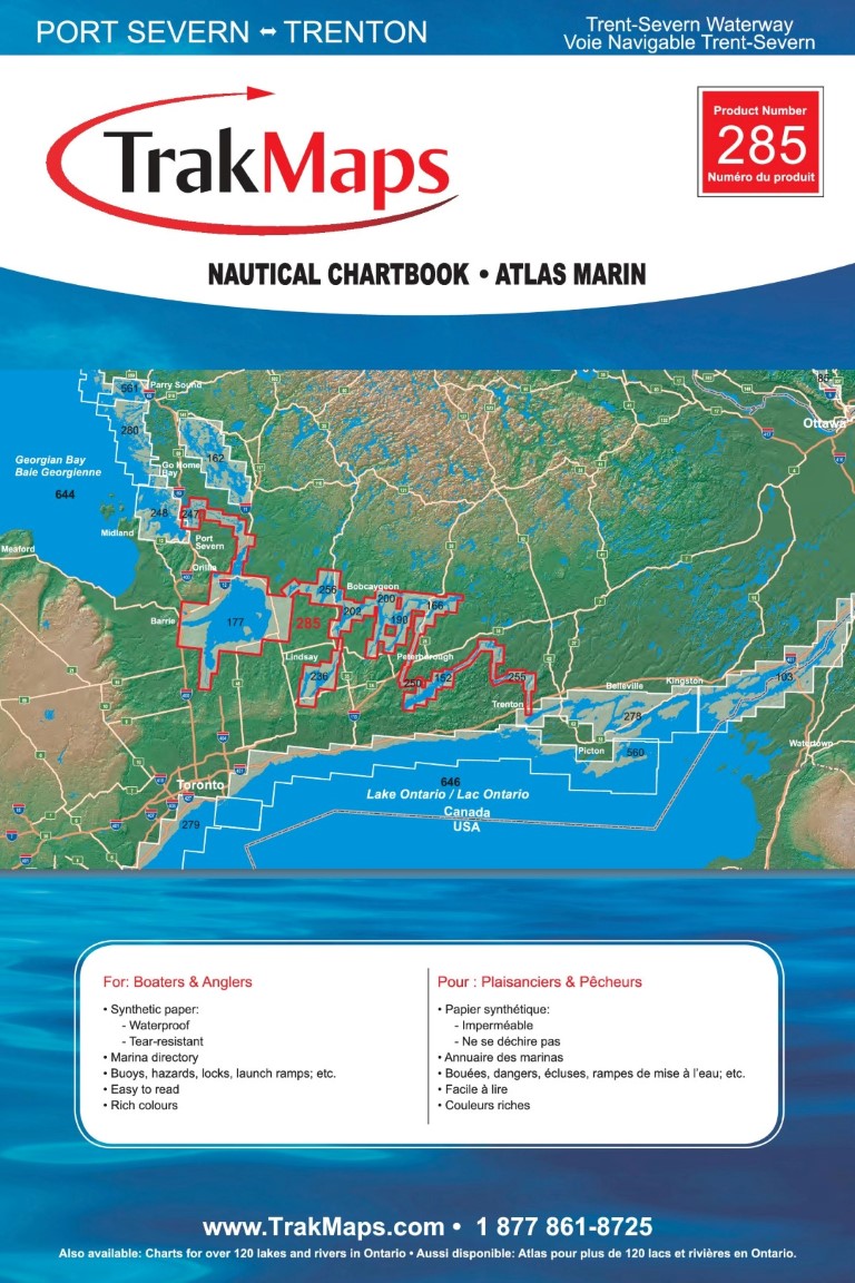
| 285 | Trent-Severn Waterway: Port Severn - Trenton | Nautical Chartbook | Trent-Severn | $159.99 |
| 256 | Trent-Severn: Balsam and Cameron Lakes | Nautical Chartbook | Trent-Severn | $29.99 |
| 236 | Trent-Severn: Lake Scugog | Nautical Chartbook | Trent-Severn | $28.99 |
| 177 | Trent-Severn: Lakes Couchiching and Simcoe | Nautical Chartbook | Trent-Severn | $39.99 |
| 200 | Trent-Severn: Pigeon Lake | Nautical Chartbook | Trent-Severn | $29.99 |
| 247 | Trent-Severn: Port Severn - Couchiching | Nautical Chartbook | Trent-Severn | $29.99 |
| 152 | Trent-Severn: Rice Lake | Nautical Chartbook | Trent-Severn | $29.99 |
| 166 | Trent-Severn: Stony Lake | Nautical Chartbook | Trent-Severn | $29.99 |
| 202 | Trent-Severn: Sturgeon Lake | Nautical Chartbook | Trent-Severn | $27.99 |
| 132 | Tupper Lake and Adirondack Region | Individual Chart | New York | $15.99 |
| 132 | Tupper Lake and Adirondack Region | Stretched Canvas | Individual Chart | New York | $79.99 |
| 514 | Upper and Lower Manitou Lake | Individual Chart | Northern Ontario | $34.99 |
| 514 | Upper and Lower Manitou Lake | Stretched Canvas | Individual Chart | Northern Ontario | $119.99 |
| 121 | Upper Rideau Lake | Individual Chart | Frontenac | $15.99 |
| 121 | Upper Rideau Lake | Stretched Canvas | Individual Chart | Frontenac | $79.99 |
| 125 | Upper, Middle and Lower Saranac Lake | Individual Chart | New York | $24.99 |
| 125 | Upper, Middle and Lower Saranac Lake | Stretched Canvas | Individual Chart | New York | $109.99 |
| 492 | Wabigoon and Dinorwic Lakes | Individual Chart | Northern Ontario | $29.99 |
| 492 | Wabigoon and Dinorwic Lakes | Stretched Canvas | Individual Chart | Northern Ontario | $124.99 |
| 156 | White Lake | Individual Chart | Ottawa Valley | $15.99 |
| 156 | White Lake | Stretched Canvas | Individual Chart | Ottawa Valley | $79.99 |
| 146 | William Lake | Individual Chart | Centre-du-Québec | $15.99 |
| 146 | William Lake | Stretched Canvas | Individual Chart | Centre-du-Québec | $79.99 |
| 197 | Wolfe Lake | Individual Chart | Frontenac | $15.99 |
| 197 | Wolfe Lake | Stretched Canvas | Individual Chart | Frontenac | $79.99 |