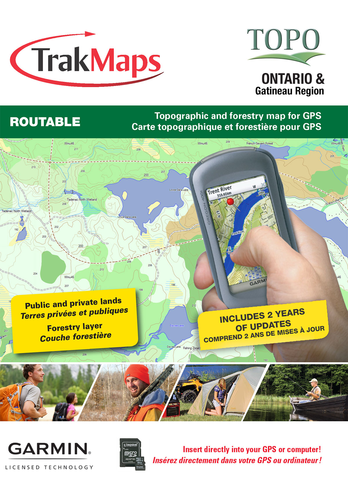
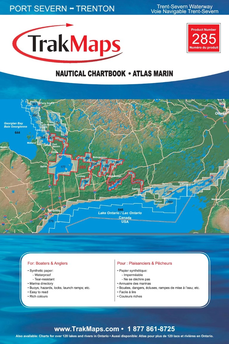
Waterproof chart of Thwaites Ice Tongue to Thurston | NGA Chart 29200 | TrakMaps

Thwaites Ice Tongue to Thurston | NGA Chart 29200

ORDER IT TODAY

$34.50
or
Find a Retailer


Official Chart

Specifications

FormatNGA Chart
PresentationRolled
Legend
FinishSynthetic
Dimensions51" x 35"
Pages1
Scale1:500,000
Please note that map dimensions are sometimes rounded rounded. To obtain precise dimensions, please contact us.

Features

  • Bathymetry
  • Navigation aids
  • Navigation hazards
  • Printed on waterproof and tear-proof paper

Description

Thwaites Ice Tongue to Thurston | NGA Chart 29200. Printed on waterproof and tear-proof paper. Perfect for boating and fishing.

Examples


Coverage

The red rectangle in the map above is only to indicate the area covered. It does not represent the actual content of the product.

Find Other NGA Charts


I am going to

11
7
58
8
12
6
2
3
152
5
2
32
28
4
10
9
14
9
4
4
3
2
17
21
2
5
3
12
14
14
Chart
Price
Loading, please wait...
Chart
Price
No matching records found

Testimonials