NOAA Custom Chart (NCC) - ANSI D (22 x 34)
What is the NOAA Custom Chart (NCC) application?
NOAA Custom Chart (NCC) is an online application that enables users to create their own customized nautical charts directly from the latest official NOAA electronic navigational chart (NOAA ENC®) data.
What is the process of creating a NOAA Custom Chart (NCC)?
After creating your chart on the NCC app, please come back to this page and enter your filename in order to add it to cart.
After placing your TrakMaps order, please respond to the TrakMaps email receipt with the chart PDF file so we can ship your chart on high-quality waterproof & tear-resistant synthetic paper, delivered right to your door.
Ships TODAY or next business day with delivery 1-3 business days later for many locations
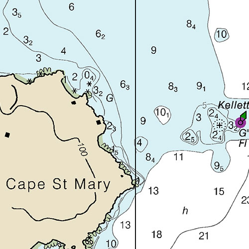
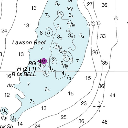
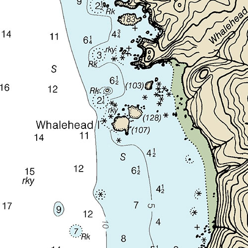
Includes
- Bathymétrie
- Aides à la navigation
- Entraves à la navigation
- Imprimé sur papier imperméable et indéchirable
ORDER IT TODAY
Description
Sources
- Canadian Hydrographic Service
- Quebec Ministry of Energy and Natural Resources
- National Oceanic and Atmospheric Administration
- Natural Resources Canada
- Ontario Ministry of Natural Resources and Forestry
- National Geospatial-Intelligence Agency
- TrakMaps
This product does not contain data from all sources listed above. Other sources may also be used.
Specifications
| Format | Carte du NOAA |
| Présentation | Roulée |
| Légendes | |
| Papier | Imperméable et indéchirable |
| Région | États-Unis |
| Dimensions | 22" x 34" |
| Pages | 1 |
| UPC | 838510006003 |
| * Veuillez noter que ces dimensions sont estimées ou arrondies. Pour obtenir les dimensions précises, veuillez nous joindre. | |
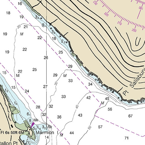
Coverage
Not sure which maps/charts to order? Plan a Trip and we'll let you know which ones you need.
Find Other NOAA Charts
Please choose the type of map(s) to display in the top-right corner of the map.
I am going to


Testimonials
We live for the outdoors
Our priority is to ensure you have the map you need to make your way around confidently and safely.
Our Partners
We work with a wide variety of associations, federations, government ministries and corporations to bring you the best products on the market.