Know where you are!
Lake Memphrémagog
Ships TODAY or next business day with delivery 1-3 business days later for many locations
Includes
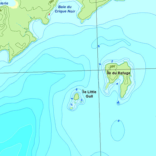
- Bathymetry
- Navigation aids
- Navigation hazards
- Main roads
- Fishing spots
- Diving sites
- Marinas
- Launch ramps
- Tourist attractions
- Printed on waterproof and tear-proof synthetic paper
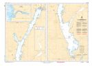
Description
Nautical Chartbook of Lake Memphrémagog in Estrie (Quebec). Printed on waterproof and tear-proof paper at a scale of 1:25,000. Perfect for fishing, boating and ice fishing.
Recent Data
This nautical chartbook includes notices to mariners up to April 30, 2024.
Sources
- Canadian Hydrographic Service
- Quebec Ministry of Energy and Natural Resources
- National Oceanic and Atmospheric Administration
- Natural Resources Canada
- Ontario Ministry of Natural Resources and Forestry
- National Geospatial-Intelligence Agency
- TrakMaps
This product does not contain data from all sources listed above. Other sources may also be used.
Specifications
| Product # | 533 |
| Format | Nautical Chartbook |
| Presentation | Spiral-bound |
| Legend | |
| Paper | Waterproof & tear-proof |
| Region | Estrie |
| Dimensions | 12" x 18" |
| Pages | 8 |
| Scale | 1:25,000 |
| UPC | 838510005334 |
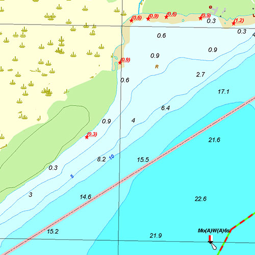
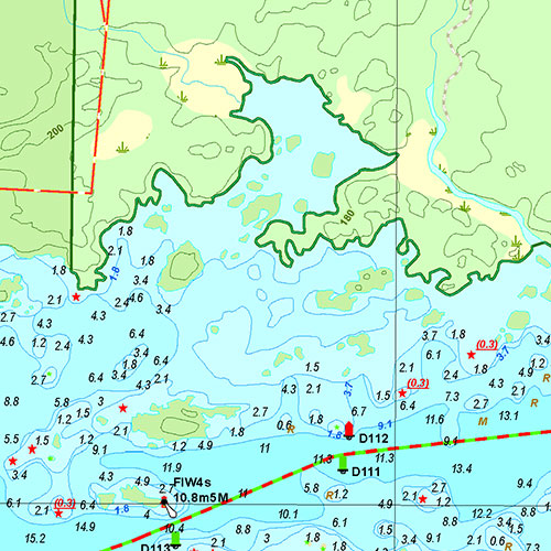
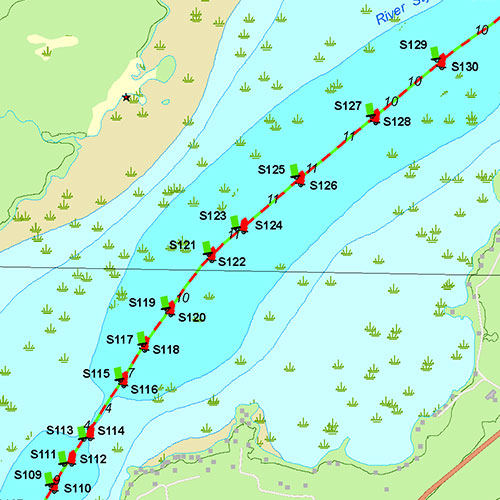
Above images are for demonstration purposes only.
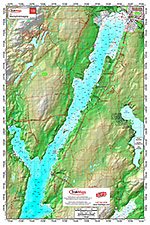
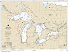
Coverage
Not sure which maps/charts to order? Plan a Trip and we'll let you know which ones you need.
The red rectangle in the map above is only to indicate the area covered. It does not represent the actual content of the product.
Find Other Nautical Chartbooks
I am going to
As Featured In
Testimonials
We live for the outdoors
Our priority is to ensure you have the map you need to make your way around confidently and safely.
Our Partners
We work with a wide variety of associations, federations, government ministries and corporations to bring you the best products on the market.